
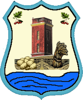
Origin of the village name
According to local history:
The origin of the settlement’s name is in connection with the bush plant, with spine arms, white flowers and small red berry’s – GLOG (Hawthorn)
In old times this plant covered most parts of today’s settlement. Today You can find it only on a few places, near the roads.
On an old topographic map Glogonj village is the first time named in 1586, like a village which belongs to Pancevo sandzak /Turkish word – means something like canton/.
The same name also appeared on the Land-registry between 1600 &1606.
General Mercy between 1723 &1725 accomplished topographic measurements of the Banat. On that new map Glogonj is marked as a desolated settlement named GLOKANSNA.

Mass colonizations took a place a few years later –
German’s arrived in 1774, and Romanians in 1781.
The oldest discovered items indicate that there possibly was a village in the bronze age. Some items discovered were – 3 bronze bracelets, medal, a part of bronze armor, clay receptacle with green drawing, and 3 yellow dots on it.
Items which appeared to be from the Roman period were also discovered, they were a metal bracelets /emperor Aurelian/, a few clay receptacles ornaments which were characteristic for that period.
All these items were discovered around the area today that is a pump station, on a place called “Umka”, on the right side of the road to Pancevo.
They were found at a depth of about 2 meters, during the building of the pump station, they also discovered a complete shelf with clay dishes.
There are two narrations:
- During the works around the building of the culture club, they discovered two stone chest’s.
One of them was thrown in the well, which is filled up later. The other chest disappeared.
The chest’s like those were characteristic for Roman higher officer’s.
-On the north of the village, near the former stable, a discovery of two skeleton’s with ornament’s and weapon’s dated from the time of the Hun’s breakthrough on those territories (X – XII century)
Settlement Glogonj
Glogonj belongs to a group of the river Tamis settlements.
Settlement has rectangular shape,( with the length of the 2000, an the width of the 800 meters ) with rectilinear & crosswise placed streets. The village is panonic type, center of the village is broad, and the streets are 20-40 meters wide.
There are 6 streets, whose are lying northwest – southeast, with next names at this moment:
Tamiska, Oslobodjenja, 1.Maj, Skolska, Mlinska & 4.Oktobar.
On the north-west end you can find the first transverse street (houses are only at one side) named Utrinska – lies from southwest – north east, followed by:
Partizanska, 29.Novembra, Proleterska, Beogradska, JNA, 8.Marta, Borisa Kidrica
& Zarka Zrenjanina. Center of the village still bear name – Trg Marsala Tita
Every house has courtyard with buildings for agricultural needs, and kitchen-gardens or orchard in the dip.
In the center of the village you can find a park, square shape ( 210×170 meters ).
Foot-paths are concreted in 1988 (before that there was not any cradle), they cat each other diagonally, and the others cut the park in 4 equal square parts.
In the village you have primary school, ambulance station, aqueduct, telephones in 70% of the houses, and gas pipeline.
Economy
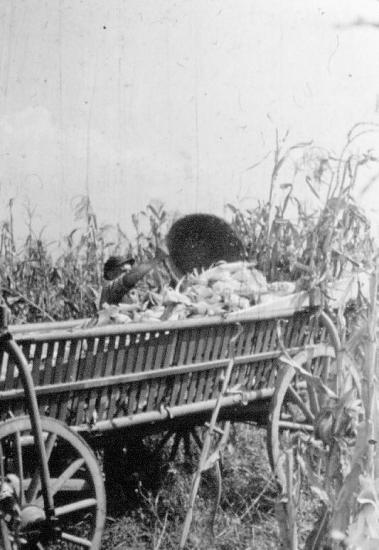
In Glogonj most important industry is agriculture.
District is rectangular whit altogether surfaces of the 4291,5 ha,
part of that land is farmland, what occupy 4086,7 ha .
Arable land occupy 3036,1 ha or 74,3%.
And uncultivated land occupies a notable territory:
grass-land 324.8 ha, forest 548.5 ha, until unproductive land overtake 308,9 ha.
In private sector there is 2052.6 ha (47,8%), until corporate sector overtake 2238.9 ha (52,2%).
On Glogonj territory in sowing structure main place takes cereal: wheat, corn & barley.
After that you can find sunflower, soya & sugar-beet.
Gardening is highly developed – most important culture is potato ( is developed growing of ‘young’ potato), also bean, onion, tomato, paprika. Part of that production is assigned to market-place in Pancevo & Belgrade.
Cattle-breeding is as a matter of fact in decrease & you can find it only in private sector.
Stock 1981 – 1991 year.
Year Swains Cattle Horses Sheep’s Fowl
1981 2370 168 121 334 17800
1991 1732 28 24 137 11353
Public property corporation “Glogonj” – PIK-a “Tamis” possessing (data from 1991) altogether 1237 ha arable land. They cultivate usual rural culture and main is cereal: wheat (383ha), corn (309ha) & barley (38ha). After that you can find sunflower (123ha), soya (156ha) & sugar-beet (128ha).
* SOURCE – PROVINCIAL INSTITUTE FOR STATISTIC, Statistic bulletin 206, Novi Sad 1991.
——————————————————————————–
River Tamis – naturally
Sometime Tamis was creek of river Tisa, but during the time displaced it’s own delta southward & become affluent of the river Danube.
Delta was near to today’s effluence Karas.
Tamis is bringing a lot of water from upper streaming, frequently it’s behavior is like wild river.
Because of so little inclination & tray, Tamis frequently lap dissolves.
Filling his delta and lap dissolving, Tamis changed the direction toward Danube, he splinted in to a few creeks: Karas & Dunavac on the NW from Opovo; Vizelj on the South of Borca ; Sibnica of the SE from Ovca & Tamis (main delta at Pancevo).
Vizelj ( Hungarian name) inflows in Dunav at 2 places :
like Dunavac, north of Belgrade & like Kalovita, south of Ovca.
Vizelj & Kalovita are linked with Sebes.
Geographic location
Glogonj belongs to Pancevo municipal – Autonomous Province of Vojvodina – Republic of Serbia.
The GPS coordinates for Glogonj are Latitude 44′ 59′N, Longitude 20′ 33′E & Altitude 75 m.
The village is on the contact of alluvial plate of the river Tamis, and Banat plate .
Glogonj village belongs into a group of littoral establishments, and lines with the area of the next settlements:
Sefkerin, Crepaja, Jabuka & district of the city Belgrade.

Something about relief of Glogonj
Alluvial plate solicitude lowest parts of the area lying between left coast of the river Tamis & a part of Banat plate on the altitude of 73 meters.
Banat plate occupies the biggest part of the village Glogonj with altitude of 75 – 79 meters.
There are a lot of underground & surface water.
Glogonj is supplying with drinking water from the three wells, whose deep reaches 96 meters.
On Glogonj territory river Tamis has low downfall, what is the reason for winding, that developed bight & backwater. The rivers high water-level produce danger of the often floods.
On the village Glogonj district prevailing land structure is mold, and so called ’solonjec’ around the river Tamis.
Inhabitants of Glogonj
Source for Data about Glogonj inhabitants is Geographic institute – College Novi Sad,data are mostly based on census from 1991.
According to the census from 1991 there were 3475 citizens in Glogonj. Glogonj was considered a part of a smaller village of Pancevo commune.
During this time the number of villagers fluctuated-
By 1900 the numbers had increased, then began period where the numbers constantly decreased until 1931.
The cause was W.W.I (1914-1918) & W.W.II (1941-1945), and emigration, mostly to America.
In 1944 the German population was forced to leave Glogonj.
From December 1945 till 1948 about 400 families were colonized in Glogonj, most are from Macedonia.
Between 1948-1953 some of the new colonists, because they couldn’t find permanent housing – returned back in Macedonia.
From the 1950’s until 1981 the population continued to increase.
Between 1981 and 1991 numbers start to decrease again. This time the reasons are: the number of births are decreasing, people find work in cities and have to move. And many others move abroad.
The census from 1991 shows the number of males (1779) is a little bigger then number of females (1696).
Age distribution:
957 are between the ages of 0-19 or 27.5%.
1,882 are considered middle age or 54.2%
1,027 are between the ages of 0-39
855 between 40-59, and
615 are over 60 years old, 17.7%
The nationality’s in 1991.consist of:
2022 Serbians 58,3%
820 Macedonians 23,7%
247 Romanians 7,1%
227 Yugoslavians 6,6%
19 Hungarians
16 Croatians
5 Montenegrins
etcetera
The nationality’s in 2002.consist of:
2400 Serbians 75,51%
367 Macedonians 11,54%
156 Romanians 4,90%
106 Yugoslavians 3,33%
26 Hungarians 0,81%
6 Croatians 0,18%
2 Montenegrins 0,06%
etcetera
According to the incomes there are
109 agricultural families, 864 non-agricultural, 55 mixed & 33 families without regular incomes.
Because of the dramatic changes from 1991 many refuges from the former Yugoslav republics have colonized in Glogonj. At the same time emigration increases from Glogonj & Yugoslavia because of aggravaed condition of life caused by sanctions, and the constant threat of war.
Chart – Number of citizens in Glogonj
Source* regional atlas of Vojvodina
Institute for geography – PMF Novi Sad
Year of census – Number of citizens
1869 – 2749
1880 – 2468
1890 – 2911
1900 – 2974
1910 – 2662
1921 – 2659
1948 – 2678
1953 – 3175
1961 – 3230
1971 – 3257
1981 – 3605
1991 – 3475
2002 – 3281
Chart – index of citizens colonized from Macedonia
Source* Geographic topography of Pancevo
Area of descent – Number of families
Kriva Palanka & area – 57
Kumanovo & area – 234
Ohrid & area – 33
Skoplje & area – 49
Area of Struga – 10
Other areas – 29
Totally : 412
Chart – number of citizens 1961 – 1990.
Source* Geographic monograph of Vojvodina municipals Geographic institute – PMF Novi Sad
Period born died natural increase
broj % broj % broj %
1961-1970 477 14.7 265 8.2 912 6.5
1971-1980 536 15.6 281 8.2 255 7.4
1981-1990 519 14.4 345 9.7 174 4.7
Glogonj History
The original Settlers lived in cabins.
These settlers mostly hunters and fishermen, who became farmers.
During this period, some of the families in Glogonj, emigrated from old Serbia.
The Hungarian government needed soldiers at the borders (Austria/Hungary – Turkish Borders). In order to recruit new settlers, they were given many privileges. These recruits became border police.
This was the birth of the military border police.
There were about 240 soldiers at Pancevo-Opovo border station, which included Glogonj and Jabuka.
Residents of the village were also soldiers at this time. Payment for their service was given in land. They were allowed to use the land for farming, free of land-taxes. And they were given other privileges.
1586 – Glogonj was registered as a village for the first time
1660 – The deputy of Pecka Patriarchy listed 168 settlements in Banat, which included Glogonj.
1704 – The military border was formed which included Glogonj.
1716 – Glogonj is listed as having 15 houses
1717- Another source list Glogonj with 10 houses with Jabuka having 15 houses.
1723-25 – According to the Mercy’s map – our village is desolated. It is identified as Glokansna.
1765 – The first school called “Trivial Schule” was mentioned.
Josif Panacek was the first teacher until 1777.
Teachers were guaranteed a home with a years salary of the 176 forints & 4 cubic of firewood.
1767 and become seat of the 4 soldiery German – Banat boundary regiment No.12. In Glogonj soldiery belongs Sefkerin, Borca & Ovca. The Military headquarters was a house which was used as a municipal house until 1910.
1768 may 09. – Glogonj visited emperor Jozef II. Emperor Joseph II was the eldest son of Maria Theresia queen of Hungary and Bohemia, and archduchess of Austria.
1771-72 The Serbian families of the village left because of cruel military control of the area.
1774 – German colonists began arriving. These colonists included people from Germany, Alsace Lorraine, Belgia, Italia, Spain, Moravia and Bohemia. The Banat Governor during this time was Mercy.
1775 – The first Catholic Church is built and the school is opened.
1779 – Glogonj now has 856 citizens.
1788 – In the end of September the village is attack by Turk’s. They are robbed and their homes are burned. Those villagers that died were buried on the left coast of the river Tamis, at the south-west end of the village.
1790-91 – A cholera epidemic came to Glogonj, where many died.
1781 – Emperor Joseph II sends more Roman immigrants from Zitiste ( (today known as Begej Sveti Djuradj). They were the first organized group of Romanians in Glogonj. There were also families from Ardeal, who were rebelling against the authorities at the time.
1794 – More Romanian families have immigrated from Sibiu, Romania.
At that time some Hungarian families immigrated from Magyar-Itebe & Hodnez’o'rasarhaly Hungary. Hungarian families integrated with the Germans.
1800 – More Romanian families immigrate from Klek & Iankaid (Jankov Most).
1806 – The Romanian Church is built, the first preacher was Isak Todorovic. (Until this time Romanians had to go to the church in Sefkerin).
1808 – The population of Glogonj is now 4/5 of Germans and 1/5 of Romanians.
1819 – The commander of the Glogonj station was Stevan Supljikac. In 1884 he became a Duke
1825 – In June there was a violent wind storm, which knocked down the tower on top of the catholic Church.
This year the municipal school opened. The first teacher was Johan Duptza.
1828 – Romanian municipal school opened. The first teacher was Jovan Popovic.
1839 -The Romanian church was given the land to build a new church.
1840 – The second Romanian church was built, where it stood until 1911.
1841 – St. Anna’s Catholic Church was built, which it remains today.
1848 – Grasshoppers invaded village, which destroyed many fields.
In September the Serbian army from Crepaja village attacked Glogonj.
They demanded 8000 gulden & cattle from Glogoners. Many Glogoners obeyed their demands and the Serbian army left.
1863 – This year had an extremely long and cold winter followed by a very hot and dry summer. There was very little food for the animals to eat, so many died. Between the crops and the animals dying there was very little for the villagers to eat, so many starved to death. The goverment was forced to provide seeds for the next years crops.
The next years crops were much better.
1865 – There are now 728 Romanians living in Glogonj.
The Romanian school has 70 students, the teacher was Nicolae Vesianu until 1877, when Djordje Jaksa becomes the new teacher.
1872 – The military border is abolished. Glogonj becomes a seat of canton for Jabuka, Kacarevo, Borca & Ovca. Unfortunately this is for a very brief period.
1873 The canton is abolished, Glogonj is merged with Pancevo canton.
- Because the military borders were abolished, the military medical corps were also gone (1872).
- Together with Sefkerin the first civilian medical facility was established, the first physician was Jozef Klajn.
- The first civilian post office was established and the first postman was Djordje Dragoj.
1876 – The “Trivial School” was abolished with the military borders. The Hungarian state school was founded.
1880 – Glogonj now has 2468 villagers.
1886 – On March 15 in Segedin, Hungary, with Hungarian goverment, bought the land around the river Tamis.
1890 – There are now 2911 villagers in Glogonj
1892 – The Romanian school has 169 students.

1901 – The library and casino are built.
1906 – The hunters association is founded.
1913-14 – A railroad overpass is built across Glogonj to Pancevo – Beckerek (Zrenjanin)
- The train station was at the entrance of the park, across the street from the primary school.
1918 – The ” Veselia ” is established, there are three sections: a mixt choir, a folklore group and a theatrical group.
1938 – The band is founded.
1940 – There are 3 bowling alleys in Glogonj, one for summer and two indoors – one is automatic. These bowling alleys are destroyed in 1946-47
- There are 3 soccer associations. One is Romanian called Yugoslavia, then Bratstvo and today Tehnodunav. The other two were German, GSK -The Glogonj Sports Club and “Aintraht”.
1943 – The streets called JNA & Oslobodjenja and the road way to Pancevo-Zrenjanin are built of stone.
1944 – This is the end of WWII for some Glogoners. But for many the tragedy is just beginning, the German families are forced to leave Glogonj.
1945 -About 400 families begin a new colonization . The begin arriving in December and continue into the next year, most are from the Kumanovo area.
1957 – The electrical power lines are built for the first time for the entire village.
1967- 68 – The wheat mill is shut down and removed from Glogonj.
1973 – About 300 families join together to build the water system. Today the water pipes serve more than 1000 households.
1978 – All the streets are paved.
1992 – On April 2, there are 3473 citizens living in Glogonj.
1994 – By September 16, there are 3607 citizens.
1989 – 580 families join together with the village Jabuka to build the gas pipeline.
( The line goes from the crossroads for Kacarevo to Jabuka).
1996 – The last part of the gas pipelines are built (from Jabuka to Glogonj).
2000 © Dorel Voštinar & Kathy Lara